 |
||||||||||||||||||||||||||||||||||||||||||||||||||||||||||||||||||||||||||||||||||||||||||||||||||||||||||||||||||||||||||||||||||||||||||||||||||||||||||||||||||||||||||||||||||||||||||||||||||||||||||||||||||||||||||||||||||||||||||||||||||||||||||||||||||||||||||||||||||||||||||||||
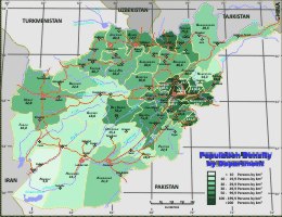
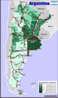
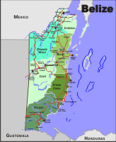
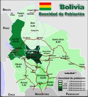
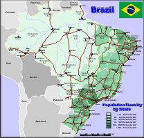
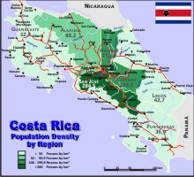
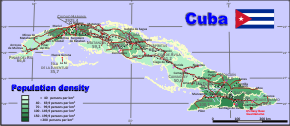
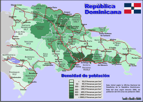
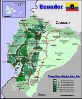
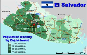
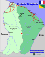
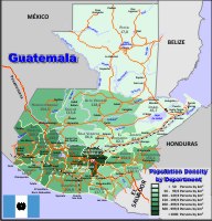
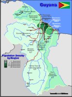
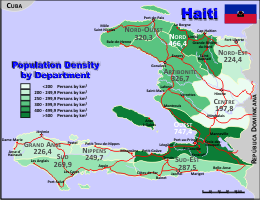
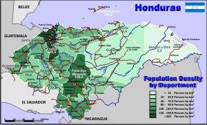
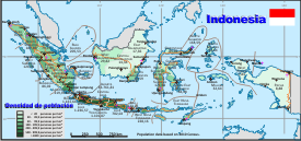
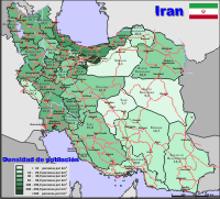
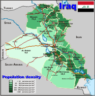
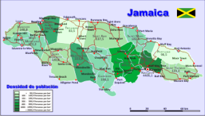
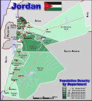
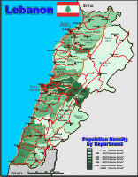
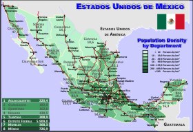
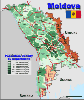
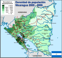
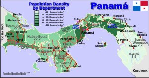
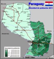
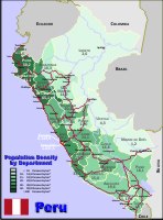
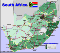
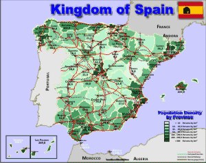
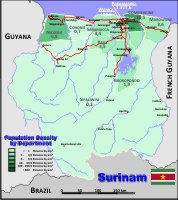
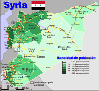
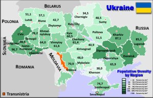
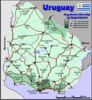
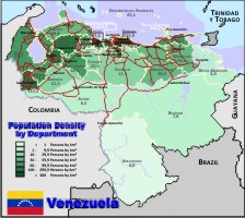
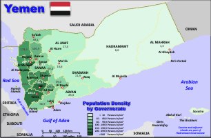
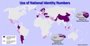
Political administrative country maps - vector graphic - Ready to use!Initial observationsOver the time of my professional life, I have elaborated many vector graphics, mostly done to visualise local statistics. Included in the maps are the first administrative level of the country: in the example of Germany, on the level of federal states; or in Colombia, the Departments; in other countries, the provinces. Thematic maps are published here as examples: in the Yemen map (territorial level of birth registration), the world map (use of national ID-Numbers) and the Lima map (habitants per police station). The territorial entities are coloured according to the incidence of the indicator to be plotted. All maps are stored as vector graphic and are therefore easy to handle and easy to build a thematic map. The advantage of the vector format is the possibility to colour each territorial unit in easy form, by mouse click. It is also possible to enlarge the map without any losses in quality. As an example, the Afghanistan map was plotted in A0 format in a good quality. An A4 PDF-file of the map is linked under the country name and the small maps.
If you are interested in
our map service - here is more information! If you
like to use the PDF-Map or a pixel graphic of the maps
so as it is, you can do this with the correct mention of
the source without costs.
If you like a pixel graphic of a map I will send it you
by mail in the required format and size. Hints for applicationMapping needs sophisticated hard- and software, special knowledge’s and qualified personal ... but there are also possibilities for low cost solutions ... have a look ... Geo mapping was easy, until the Excel version 97 it was possible to include graphics in Excel, but Microsoft has eliminated this possibility since MS MapPoint is on the market … this was an easy way. Professional solutions like ArcInfo are expansive, and it’s necessary to have special skills. But there are also easy ways … Using vector maps and a vector graphic program, it’s possible to download cost free from the Internet – as example InkScape, and a spreadsheet program – also in the Internet – OpenOffice – with the same you can extend the tables, included in the packet with your own data. The data must be later organised by the value of interest and coloured in the intervals you like to display. Assigning the corresponding colours to the areas, writing the legend and the title and the thematic map is ready. A better way to show regional data as a table … But the maps can be also imported to professional mapping software … The language version of the map is visible in the PDF-files – changes are easy and quickly possible, the naming is in each map in a separated layer. The maps are also usable as map – with out thematic data – in the size you like to have it. More information to the maps is here … Other example of thematic maps can be downloaded here. Advice for the use of the maps and their qualityAll maps are done with the best intension and as objective as possible. This is valid for the technical elaboration – defined usually by the content to be plotted over the map – but also by the mapping content (Kosovo, Nagorno Karabakh or Transnistria). The question of Kosovo as independent state is answered by each country different (Germany – yes, Spain – No) and should be answered lastly by the user. These territories are marked especially each time. There should be said anything about possible errors in the maps – generally the user is responsible to verify the correctness of the maps; the application is generally under the users responsibility. If there are errors detected, I would be happy to hear about it. Anecdotally: These trifles can have until
prosecution consequences in any countries, so is as
example the use of different maps as the official in
Peru a relevant case for prosecution … so be careful …
look to the target group … |
||||||||||||||||||||||||||||||||||||||||||||||||||||||||||||||||||||||||||||||||||||||||||||||||||||||||||||||||||||||||||||||||||||||||||||||||||||||||||||||||||||||||||||||||||||||||||||||||||||||||||||||||||||||||||||||||||||||||||||||||||||||||||||||||||||||||||||||||||||||||||||||
|
||||||||||||||||||||||||||||||||||||||||||||||||||||||||||||||||||||||||||||||||||||||||||||||||||||||||||||||||||||||||||||||||||||||||||||||||||||||||||||||||||||||||||||||||||||||||||||||||||||||||||||||||||||||||||||||||||||||||||||||||||||||||||||||||||||||||||||||||||||||||||||||